What is Topobase? – Part 2
Continuing in the spirit of my last post, I’d like to work my way up to the question of “What Is Topobase?”
To begin with, let’s revisit AutoCAD Map3D, Autodesk’s GIS program. AutoCAD Map 3D is composed of two distinct halves, classic and FDO (feature data objects). If you are working with native AutoCAD objects, then you are working on the classic half. One of the most powerful Map Classic commands is the Drawing Cleanup tool (MAPCLEAN). It fixes common drawing problems like duplicate objects, zero length objects, and excessive vertices.
While the Classic side of Map can be used as a GIS system linking data to objects and to an external database, not too many people take advantage of these features. The FDO half of Map is much easier to utilize as a GIS system, linking up a to a variety of data sources, connecting to relational databases, and displaying the FDO objects based on the information in the database tables. The FDO objects are stylized in the drawing, much like Civil 3D or Revit objects, and let you use attributes to control the appearance of the entities.
For example, if you had a database table of valves and there was a column for valve type, you could assign a different block to each valve. This is a simple example that only scratches the surface of what you can do with FDO stylization.
The main use of FDO in Map is to look at existing databases that have already been setup by another GIS system. Map bridges the gap to existing GIS. Though Map has tools to help you get a database setup from scratch, it is difficult and cumbersome to use them, which is where Topobase comes into play.
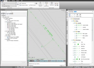
Topobase is Autodesk’s complete GIS solution, especially if you are starting a GIS system from the ground up, or have a variety of data sources/GIS systems and are looking for a cohesive solution. It is especially key in combining the AutoCAD based engineering environment with traditional GIS systems to reduce data conversion and duplication of work. Built on AutoCAD and Map 3D, users can take advantage of their existing skill set, but work in a way that maintains the integrity of the GIS. Data is not scattered about amongst a plethora of dwg’s and GIS formats, it is maintained in an up-to-date, accurate, consistent central location.
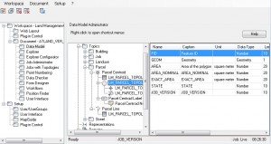
If you wanted to create a new GIS database, you would begin with Topobase Administrator. Topobase Administrator provides an interface to setup and make changes to your database, control how objects interact, control access to the data, include attributes for objects, and create reports about the objects in the GIS.


